SNAP TO ROAD API
Meet the U-turn in GPS snapping technology
Leverage precise navigation and the shortest routes with a new class of road snapping. Which city are you in? We’re coming there next.
Build maps-based apps with a clear trajectory

UNLIMITED SNAPPING POINTS
More precise and reliable navigation
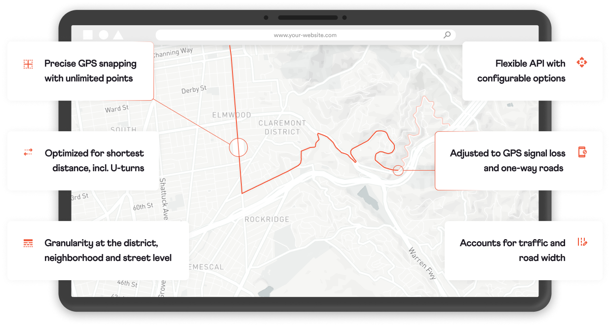
No limitations on snapping point distance and a plethora of proprietary data make our snap to road the most precise ever, especially in dense urban contexts. Build your location-based apps in full confidence.
- Unlimited snapping points
- GPS signal loss correction
- Street elevation data
- Road categories

Shortest Routes
Go big on minimizing mileage
Optimize routes by the real shortest trajectory, with precise street-level data and a realistic model of driver behavior, including U-turns and one-way streets. We built the Snap API for our digital delivery inventory advertising product, where each meter counts. It’s perfect for applications in logistics, fleet management, ridesharing and much more.
COMPETITORS
(Bing, Google etc.)
- Long driving around
- Limited U-turn options
- Occasional dead ends
OUR SNAP TO ROAD
Proprietary snapping tech
- Shortest routes
- Smart U-turn suggestions
- Dead ends cleaned up
GEOLOCATION ADD-ON
Discover customers walking roadside
Access foot traffic and residential demographics for each segment of your route, with proprietary data seamlessly integrated with the snap API. Ready for Belgrade, Serbia; easy to implement in your city.

Foot traffic
Find out how many people your route intersects with at any given time.
Points of interest
Hot spots, location types, local businesses and more, with estimated pedestrian and vehicle traffic.
Demographics
Find out who lives in which area, and the most likely demographics by point of interest. All by day & time of day.
Impressions estimates
Calculated precisely for each route by cross-referencing foot traffic and demographics.
Detailed time
Around the clock granularity on workdays, weekends, holidays. Easy to integrate special events and more.
Fine-grained locations
Detailed map and impression data by municipality, district, street, intersection, or point of interest.
Built for Belgrade, ready for your city
Use navigation and routing out of the box wherever you are. Tell us your city and we’ll implement it there next.
